|
ALL HIKERS
DAY 4: MILE
107.5
TO MILE 137, FOOTBALL FIELD CAMP |
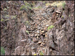
Tom gives the call for coffee this morning. Breakfast is French toast and
sausage. After pushing off from the bank, Dutton Point is visible above
Carolyn's head in the picture below. John Wesley Powell declared in 1895
that Dutton Point was his favorite place in all the Canyon. It was named
for geologist Clarence Dutton. I did a solo hike there last fall. At
7,520' the views from there are amazing.
 |
 |
Looking up at Dutton Point
5-1-2012 @ 7:37 |
Dutton Point
5-1-2012 @ 7:37 |
Carolyn points out some cables
and the remains of the tram built by William Wallace Bass near Bass Rapids. Just a
little farther downstream, we can see Holy Grail Temple in the
distance behind us. This is where Bass had his ashes
scattered after his death. That was one of his favorite buttes and is on
the north side of the River across from the South Bass Trail and Bass Rapids,
mile 108.
 |
 |
Bass cable tram remains
5-1-2012 @ 7:44 |
Holy Grail Temple
5-1-2012 @ 7:59 |
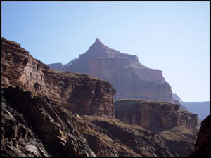
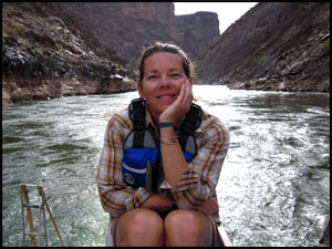
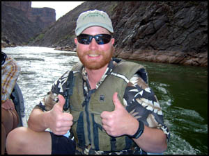
I get pictures of our crew as we drift
along.
| |
 |
|
| |
Our crew
5-1-2012 @ 8:06 |
|
 |
 |
 |
Carolyn
5-1-2012 @ 8:06 |
Amity
5-1-2012 @ 8:06 |
Tom
5-1-2012 @ 8:06 |
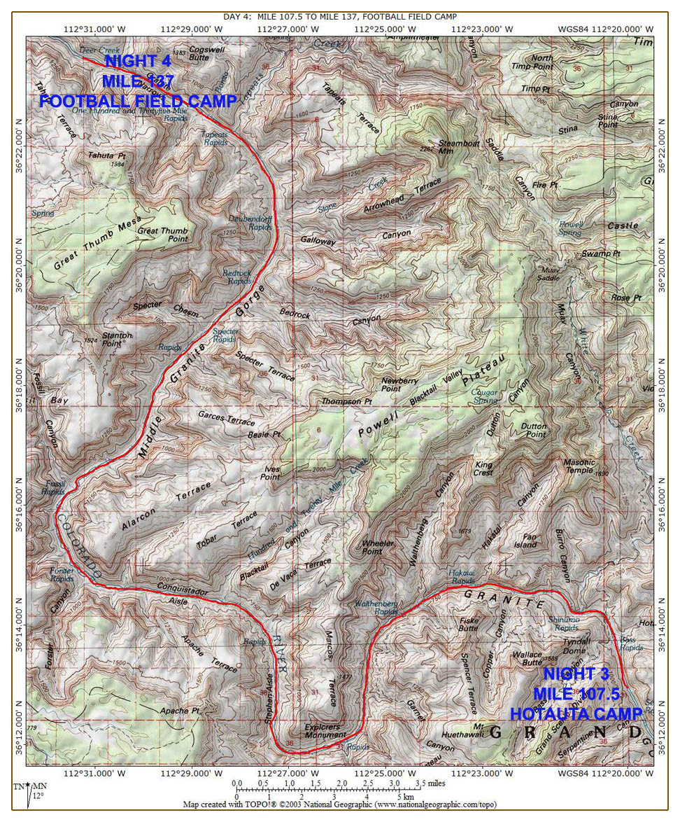
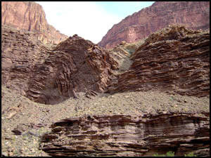
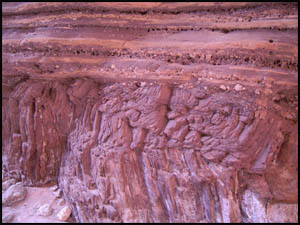
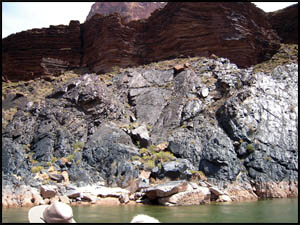
Below is an example of some rock formations that obviously underwent
tremendous forces in the past to cause that much bending.
| |
 |
|
| |
Bending formations
5-1-2012 @ 8:46 |
|
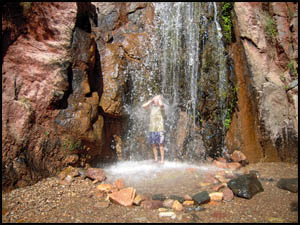
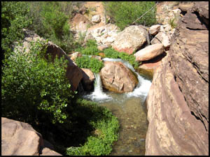
Our first stop of the day is Elves
Chasm, mile 116.5. As we unload, a colorful lizard poses for us on top a rock.
After just a short uphill hike, we reach the falls. It's easy to see
why this is one of the most photographed places in the Canyon. It's
simply gorgeous. The area is as pretty as all the postcards depict.
Several people dive in the pool, climb up behind the falls, and get their
picture taken.
 |
 |
A colorful lizard
5-1-2012 @ 9:00 |
Elves Chasm
5-1-2012 @ 9:09 |
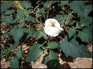
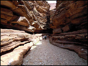
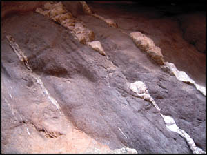
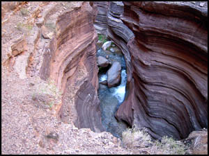
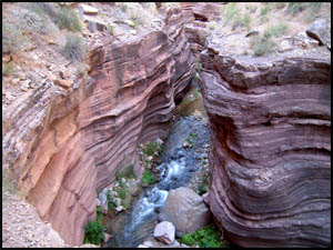
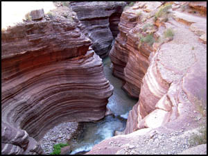
Our next stop is Blacktail Canyon at mile 120. It has
an excellent example of a geological unconformity, an area where one or more
formations in time are missing.
 |
 |
Sacred Datura
5-1-2012 @ 10:37 |
Blacktail Canyon
5-1-2012 @ 10:37 |
 |
 |
 |
Great Uncomformity
5-1-2012 @ 10:37 |
Angular rock formation
5-1-2012 @ 10:45 |
Small falls at the end
5-1-2012 @ 10:47 |
We stop for lunch just above Randy's
Rock, mile 127, named for the river guide who, while hung over and napping, allowed a
passenger to paddle their raft under a large rock so that the boat was
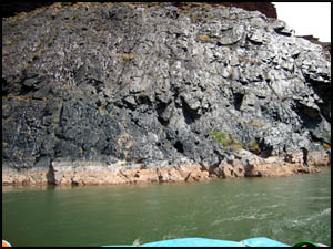
unrecoverable. Lunch is a taco salad. We soon pass areas with
numerous sections of black, volcanic rock.
 |
 |
Volcanic rock
5-1-2012 @ 1:28 |
Volcanic rock
5-1-2012 @ 1:28 |
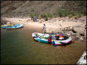
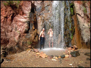
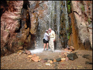
Our next stop is Stone Creek Falls at
mile 132.
It's a short hike up to the falls, where several of the group refresh
themselves under the falls, which are considerably warmer than the Colorado
River.
| |
 |
|
| |
Rafts at Stone Creek falls
5-1-2012 @ 2:11 |
|
 |
 |
 |
Craig and Rud
5-1-2012 @ 2:25 |
Laurie and Glen
5-1-2012 @ 2:28 |
Carolyn
5-1-2012 @ 2:31 |
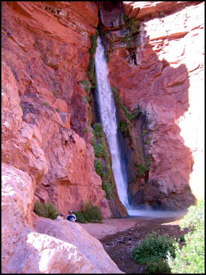
Our last stop of the day is Deer Creek Falls at
mile 136.
Surprisingly, we are the only raft here. Usually this place is
crowded. Quite a few of us want to hike up to the Patio, but we are
running behind schedule, so Carolyn and Tom challenge us to be speedy.
The group doing the hike is fairly athletic and we make the climb/hike to
the top in eleven minutes, a new record according to Tom. The walk
through the Narrows is a really neat experience. I can't imagine how
many years it took the flowing water to cut the numerous striations through
the solid rock.
 |
 |
 |
The Narrows
5-1-2012 @ 3:48 |
The Narrows
5-1-2012 @ 3:49 |
The Narrows
5-1-2012 @ 4:00 |
At the north end of the Narrows is an area called the Patio and some small
waterfalls. This is an extremely pretty area. We are fortunate
there are no other rafters or hikers here, so we have the place to
ourselves.
 |
 |
 |
Waterfall at the Patio
5-1-2012 @ 3:51 |
The Patio
5-1-2012 @ 3:52 |
Deer Creek
5-1-2012 @ 3:53 |
Craig, Traci, Tim, and I get our picture taken in the Patio. Some
industrious hiker has been hard at work on some rock art.
 |
 |
Craig, Richard, Traci, and Tim
5-1-2012 @ 3:57 |
Interesting rock art
5-1-2012 @ 3:58 |
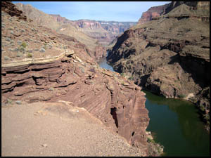
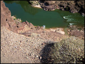
We walk back to the overlook, high above the River and our raft. The
views up and down river are quite good. The hike down to the River is
considerably less strenuous than it was going up.
 |
 |
 |
Above Deer Creek Falls
5-1-2012 @ 4:15 |
Our raft far below
5-1-2012 @ 4:15 |
Nearly back to the raft
5-1-2012 @ 4:24 |
Deer Creek Falls, the Narrows, and Elves Chasm are some of my favorite
places in the Canyon. Deer Creek Falls is the highest falls in the
Grand Canyon and is another highly photographed feature.
| |
 |
|
| |
Deer Creek Falls
5-1-2012 @ 4:26 |
|
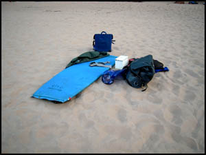
We stop for the night just downstream at Football Field Camp, mile 137, an area
roughly the shape and size of a football field. I've given up trying
to find an isolated camping spot and just put my stuff down near the boat.
Being near the serving table and my alcoholic beverages has definite
advantages, though.
 |
 |
 |
Richard's camp spot
5-1-2012 @ 6:40 |
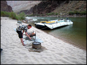
Tom at the grill
5-1-2012 @ 6:39 |
Carolyn and Amity cooking
5-1-2012 @ 6:39 |
Supper tonight is hamburgers, French fries, and brownies. The pressure is on
our crew to get our French fries nice and crunchy.
MAIN INDEX
|
HIKING INDEX
|
BACK TO DAY 3
|
FORWARD TO DAY 5
|
Copyright © Richard M. Perry, 2004-2026. All rights reserved. This web site, its text, and pictures may
not be copied without the express written consent of Richard M. Perry. |
|