| ALL HIKERS
SOUTH RIM - EAST DRIVE |
|
  The
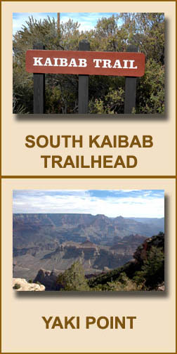
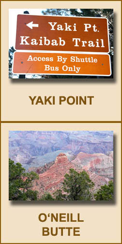
first turnoff on the East Drive is Yaki Point, which is named for the
Yaqui Indians. For most of the year
(March-November), you are required to take the free shuttle bus there.
The Park Service is considering closing it to private vehicles year round.
Yaki Point is the trailhead for the South Kaibab Trail, one of the
Canyon's popular Corridor trails. There are wonderful views of the
inner Canyon from Yaki Point. One of the distinctive features that
is readily visible is O'Neill Butte, named for
Buckey O'Neill, an early Canyon pioneer who became a member of Teddy
Roosevelt's Rough Riders. The
first turnoff on the East Drive is Yaki Point, which is named for the
Yaqui Indians. For most of the year
(March-November), you are required to take the free shuttle bus there.
The Park Service is considering closing it to private vehicles year round.
Yaki Point is the trailhead for the South Kaibab Trail, one of the
Canyon's popular Corridor trails. There are wonderful views of the
inner Canyon from Yaki Point. One of the distinctive features that
is readily visible is O'Neill Butte, named for
Buckey O'Neill, an early Canyon pioneer who became a member of Teddy
Roosevelt's Rough Riders. |
|
  The
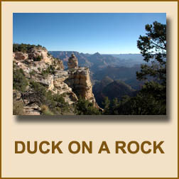
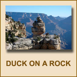
next turnoff is often referred to as Duck on a Rock. It is on one of the
many unnamed turnoffs between
Yaki Point and Grandview Point. An interesting rock formation is
there that resembles a duck sitting on a rock, hence its name. The
next turnoff is often referred to as Duck on a Rock. It is on one of the
many unnamed turnoffs between
Yaki Point and Grandview Point. An interesting rock formation is
there that resembles a duck sitting on a rock, hence its name.
|
|
 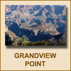 The
next turnoff is Grandview Point. It is the trailhead for the
Grandview Trail. It is another point that offers fantastic views of
the inner Canyon. Pete Berry built the Grandview Trail to give him access to
his copper mines on Horseshoe Mesa, a feature that resembles a horseshoe. The
next turnoff is Grandview Point. It is the trailhead for the
Grandview Trail. It is another point that offers fantastic views of
the inner Canyon. Pete Berry built the Grandview Trail to give him access to
his copper mines on Horseshoe Mesa, a feature that resembles a horseshoe. |
|
 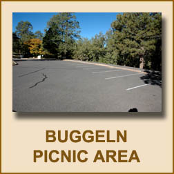 The
next turnoff is the Buggeln Picnic Area. It is named for Martin Buggeln, who lived near Grandview Point and
John Hance. Nothing
remains of his magnificent seventeen room, two-story home-hotel on his 160
acre ranch. His ranch was the last private holding purchased by the
Park Service. The
next turnoff is the Buggeln Picnic Area. It is named for Martin Buggeln, who lived near Grandview Point and
John Hance. Nothing
remains of his magnificent seventeen room, two-story home-hotel on his 160
acre ranch. His ranch was the last private holding purchased by the
Park Service. |
|
 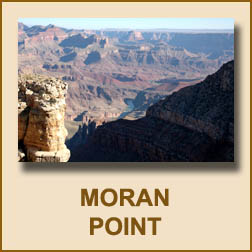 The
next turnoff is Moran Point, named for
Thomas Moran, one of
the greatest landscape painters of the American West. He spent
almost every winter at the South Rim from 1899-1920. There are
really good views of the inner Canyon and the Colorado River from here. The
next turnoff is Moran Point, named for
Thomas Moran, one of
the greatest landscape painters of the American West. He spent
almost every winter at the South Rim from 1899-1920. There are
really good views of the inner Canyon and the Colorado River from here. |
|
 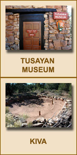 The
next turnoff is to the right and leads to the Tusayan Museum and Ruins.
It is open daily from 9:00 a.m. to 5:00 p.m.
Admission is free. The museum has numerous exhibits and pictures.
The grounds have ruins and a Kiva, a place where ceremonial activities took
place. Together, they provide a glimpse of ancestral Puebloan life
some 800 years ago. Historians believe the Pueblo Indians lived here
only about twenty years around 1185. The Grand Canyon Association runs
a book and gift store inside with all proceeds returned for the benefit of
the Grand Canyon. The
next turnoff is to the right and leads to the Tusayan Museum and Ruins.
It is open daily from 9:00 a.m. to 5:00 p.m.
Admission is free. The museum has numerous exhibits and pictures.
The grounds have ruins and a Kiva, a place where ceremonial activities took
place. Together, they provide a glimpse of ancestral Puebloan life
some 800 years ago. Historians believe the Pueblo Indians lived here
only about twenty years around 1185. The Grand Canyon Association runs
a book and gift store inside with all proceeds returned for the benefit of
the Grand Canyon. |
|
 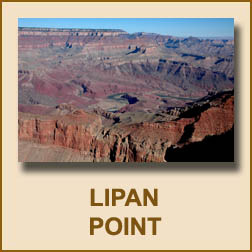 The
next turnoff is Lipan Point. It is the trailhead for the Tanner
Trail and is named for the Lipan Apache Indians of Texas. It was formerly
named Lincoln Point after the American president. It offers more great
views of the inner Canyon and the Colorado River. The
next turnoff is Lipan Point. It is the trailhead for the Tanner
Trail and is named for the Lipan Apache Indians of Texas. It was formerly
named Lincoln Point after the American president. It offers more great
views of the inner Canyon and the Colorado River. |
|
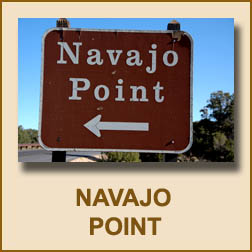 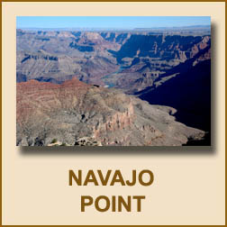 The
last turnoff before reaching Desert View is Navajo Point. At 7,461
feet, it is the highest point on the South Rim and is named after the
Navajo Indians. The
last turnoff before reaching Desert View is Navajo Point. At 7,461
feet, it is the highest point on the South Rim and is named after the
Navajo Indians. |
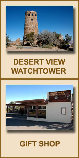 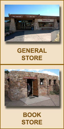 The Desert View
Watchtower is at the east entrance of the Grand Canyon South Rim twenty-six miles
from Grand Canyon Village.
Mary Jane Colter
modeled its form and construction after ancient Anasazi watchtowers.
She spent months locating
ruins and traveling to sketch and study the forms, construction, and
stonework. The seventy-foot tower was designed to take advantage of the
sweeping views of the canyon and was finished in 1932. The Grand Canyon Association runs a
bookstore next to the watchtower. A gift shop and full service grocery
store are also there. The Desert View
Watchtower is at the east entrance of the Grand Canyon South Rim twenty-six miles
from Grand Canyon Village.
Mary Jane Colter
modeled its form and construction after ancient Anasazi watchtowers.
She spent months locating
ruins and traveling to sketch and study the forms, construction, and
stonework. The seventy-foot tower was designed to take advantage of the
sweeping views of the canyon and was finished in 1932. The Grand Canyon Association runs a
bookstore next to the watchtower. A gift shop and full service grocery
store are also there. |
|
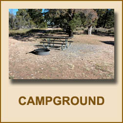 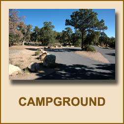 The
Desert View campground is first come, first serve and costs $12 per night.
Campsites have a picnic table and fire ring. The campground
is smaller and offers fewer services than Mather campground. The campground closes in mid-October depending on the
weather. The
Desert View campground is first come, first serve and costs $12 per night.
Campsites have a picnic table and fire ring. The campground
is smaller and offers fewer services than Mather campground. The campground closes in mid-October depending on the
weather. |
|
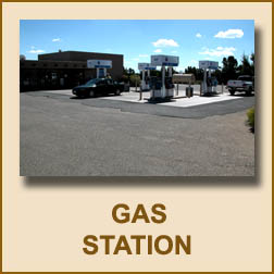 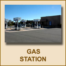 Unlike
Grand Canyon Village, Desert View does have a gas station. It
closes in mid-October depending on the weather. Gas is available from
the pumps year round with a credit card. Unlike
Grand Canyon Village, Desert View does have a gas station. It
closes in mid-October depending on the weather. Gas is available from
the pumps year round with a credit card. |
BACK TO MAIN INDEX
|
BACK TO VISITOR INFORMATION
|
Copyright © Richard M. Perry, 2004-2024. All rights reserved. This web site, its text, and pictures may
not be copied without the express written consent of Richard
M. Perry. |
|
|