|
ALL HIKERS
DAY 1:
NORTH RIM TO COTTONWOOD CAMP |

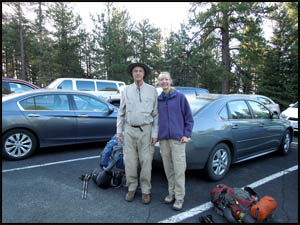
Beth and I
are up early and make it to breakfast by 6:00. Yesterday the North
Kaibab trailhead parking lot was overflowing with vehicles from trail
runners and day rim-to-rim hikers, so we are not sure we will get a place
to park this morning. However, luck is on our side and we find an
empty parking space. Another hiker takes our picture.
| |
 |
|
| |
Richard & Beth
5-19-2014 @ 6:41 |
|
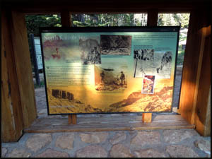
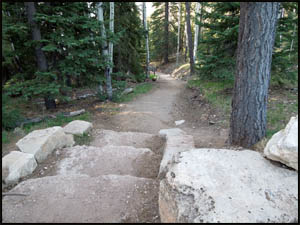
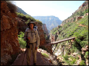
Then it's a short walk over to the trailhead. It's been thirteen years
since I was last on this trail. We start down a very smooth and well
maintained trail.
 |
 |
 |
A trailhead sign
5-19-2014 @ 6:45 |
The trailhead sign
5-19-2014 @ 6:45 |
The North Kaibab Trail
5-19-2014 @ 6:46 |
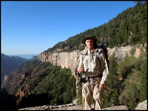
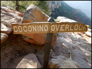
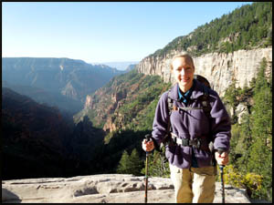
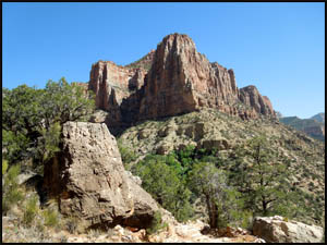
In no time at all, we reach the Coconino Overlook, which is at the top of
the white Coconino Sandstone layer of rocks. The views looking down
Roaring Springs Canyon are magnificent. The North Rim of the Canyon is
so much prettier than the South Rim and its higher elevation supports a much
different variety of trees than at the South Rim.
 |
 |
 |
Richard at Coconino Overlook
5-19-2014 @ 7:04 |
Coconino Overlook
5-19-2014 @ 7:04 |
Beth at Coconino Overlook
5-19-2014 @ 7:05 |
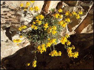
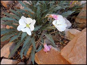
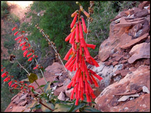
We find several different flowers in bloom.
 |
 |
 |
Fetid Marigold
5-19-2014 @ 7:13 |
Stemless Primrose
5-19-2014 @ 7:22 |
Eaton's Firecracker
5-19-2014 @ 8:15 |
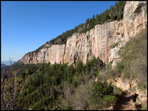
As we descend the steep trail, the views looking up toward the rim reveal
the various layers of rock we have passed through.
 |
 |
Coconino Sandstone layer
5-19-2014 @ 7:18 |
Looking back toward the North Rim
5-19-2014 @ 7:33 |
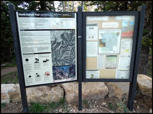
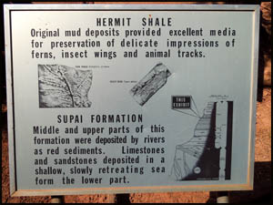
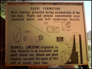
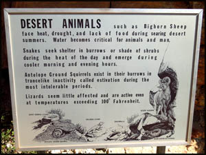
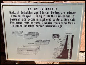
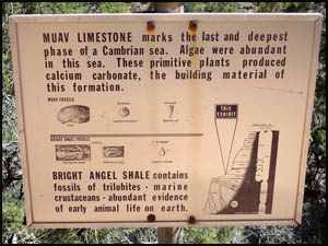
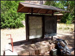
We go by several trail signs with information on the Canyon's rock layers
and desert animals. I don't recall seeing these on my other two hikes
down this trail.
 |
 |
Trail information sign
5-19-2014 @ 7:35 |
Trail information sign
5-19-2014 @ 8:20 |
 |
 |
 |
Trail information sign
5-19-2014 @ 9:00 |
Trail information sign
5-19-2014 @ 9:09 |
Trail information sign
5-19-2014 @ 9:43 |
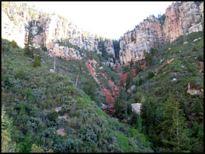
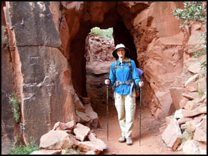
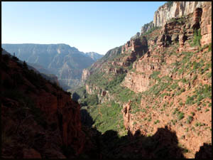
We stop for a short break at the Supai Tunnel. A large group of hikers
is here taking a break also. The views looking down Roaring Springs
Canyon just get better and better.
 |
 |
Beth at the Supai Tunnel
5-19-2014 @ 7:49 |
Roaring Springs Canyon
5-19-2014 @ 7:54 |
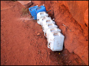
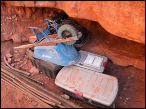
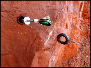
We soon come to a lot of trail crew supplies. Apparently, the workers
set anchors in the wall as a safety harness attach point when building a
stone wall at the edge of the trail.
 |
 |
 |
Trail crew supplies
5-19-2014 @ 7:59 |
Trail crew supplies
5-19-2014 @ 7:59 |
Wall anchors
5-19-2014 @ 8:00 |
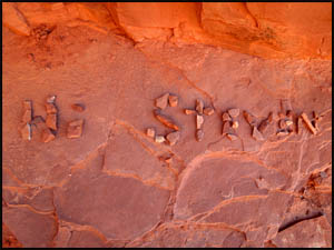
Someone has gone to a lot of effort to leave Steven a message on the Canyon
floor by assembling a lot of small stones to spell out his name.
| |
 |
|
| |
Rock art name
5-19-2014 @ 8:14 |
|
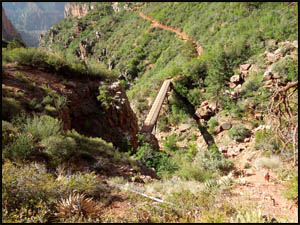
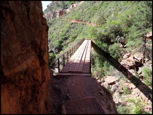
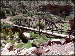
We are approaching the first of several bridges built by the Civilian
Conservation Corps (CCC) in 1936. That must have taken a lot of work
to get the bridge materials to this point.
 |
 |
 |
First bridge
5-19-2014 @ 8:22 |
Richard at the first bridge
5-19-2014 @ 8:25 |
First bridge
5-19-2014 @ 8:26 |
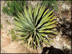
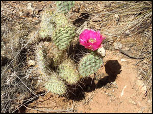
There are a lot of the usual Canyon plants along the trail.
| |
 |
|
| |
Yucca
5-19-2014 @ 9:04 |
|
 |
 |
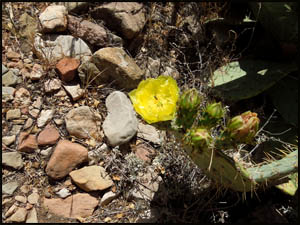 |
Prickly Pear Cactus
5-19-2014 @ 9:53 |
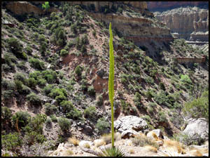
Century Plant
5-19-2014 @ 9:51 |
Prickly Pear Cactus
5-19-2014 @ 10:02 |
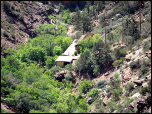
The trail makes a steep descent to the pump station at Roaring Springs.
Bruce Aiken lived at the house below here for many years with his family.
He worked at the pump station to maintain the water pumps, functions which
are now automated. One hundred
percent of the water used at the South Rim comes from here via a pipe line
that generally runs under the trail.
 |
 |
Roaring Springs pump station
5-19-2014 @ 9:15 |
Roaring Springs
5-19-2014 @ 9:33 |
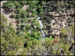
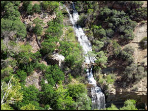
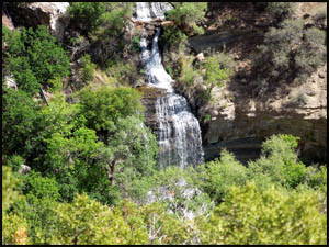
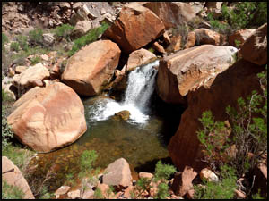
It's hard to believe that this much water just gushes out of the side of the
hill at Roaring Springs.
 |
 |
 |
Roaring Springs
5-19-2014 @ 9:33 |
Roaring Springs
5-19-2014 @ 9:33 |
Roaring Springs
5-19-2014 @ 9:36 |
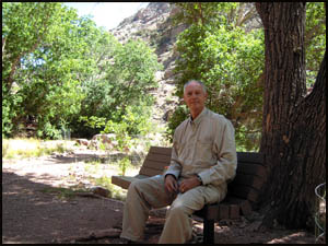
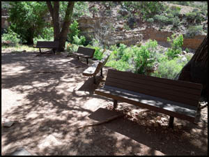
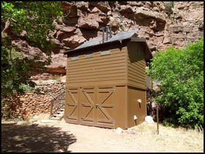
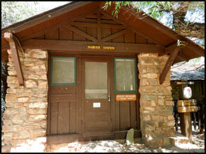
A few more minutes down the trail and we take an extended break at the old
Bruce Aiken house. They have added benches and a new bathroom here.
The Park Service has converted his house into a Ranger Station. Aiken
was still living here the last time I was on this trail.
 |
 |
Aiken rest area sign
5-19-2014 @ 10:05 |
Richard at the Aiken rest area
5-19-2014 @ 10:07 |
 |
 |
 |
Aiken rest area
5-19-2014 @ 10:05 |
Aiken rest area
5-19-2014 @ 10:27 |
Aiken rest area bathroom
5-19-2014 @ 10:27 |
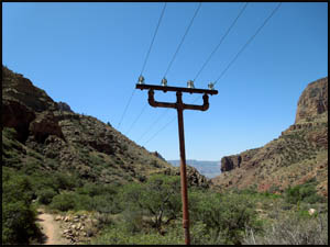
It is just over one mile to Cottonwood Camp. Two college age girls
leave the rest area just before we do headed that way. No doubt they
will beat us there and claim one of the better campsites. The trail
follows alongside a very pretty Bright Angle Creek. This old pipe telephone
pole was part of the Trans-Canyon telephone line, one of the many projects
built by the CCC. I wonder if the telephone line still works.
 |
 |
 |
Bridge over the creek
5-19-2014 @ 10:35 |
Bright Angel Creek
5-19-2014 @ 10:40 |
Old telephone pole & lines
5-19-2014 @ 10:49 |
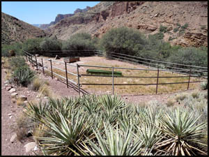
We pass an old mule pen just as we pull into Cottonwood Camp. It does
not appear to have been used in many years. Sure enough, the two girls
who left the rest area just before we did beat us here by two minutes and
claim the best site.
 |
 |
 |
Mule pen
5-19-2014 @ 11:07 |
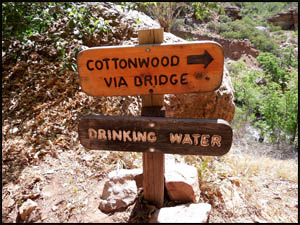
Cottonwood Ranger Station
5-19-2014 @ 11:29 |
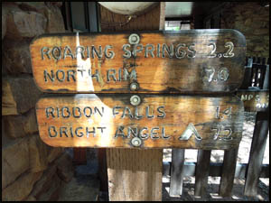
Trail sign
5-19-2014 @ 11:29 |
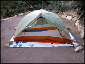
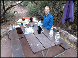
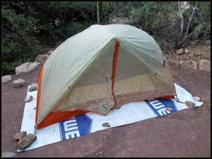
Beth and I put our stuff down in one of the remaining campsites and have
lunch. It's a little too hot to set up our tents, so we explore some
around camp. We meet a couple who have come from Phantom Ranch headed
to the North Rim. I don't envy them because they still have about
seven miles and over 4,000 vertical feet to go. After it cools down
some, we set up camp and have supper. The North Rim Lodge is visible
from here, but it is hard to see until after dark when its lighting
pinpoints its exact location at the rim edge.
 |
 |
 |
Beth's tent
5-19-2014 @ 5:38 |
Beth at Cottonwood Camp
5-19-2014 @ 5:38 |
Richard's tent
5-19-2014 @ 5:42 |
Tomorrow we are going to see Ribbon Falls on the way to Bright Angel
Campground.
MAIN INDEX
|
HIKING INDEX
|
BACK TO
PREFACE |
FORWARD TO DAY
2
|
Copyright © Richard M. Perry, 2004-2024. All rights reserved. This web site, its text, and pictures may
not be copied without the express written consent of Richard M. Perry. |
|