|
ALL HIKERS
KEN PATRICK
TRAIL |
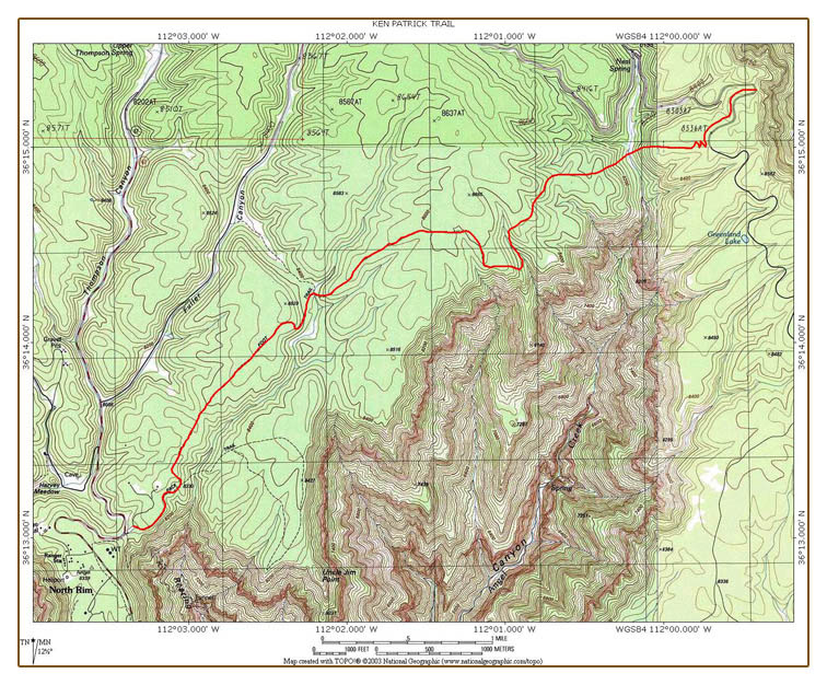
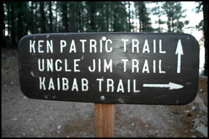
The Ken Patrick Trail begins on the east
side of the North Kaibab Trail parking lot next to the mule pens.
It is named for a long time Canyon Park Ranger slain in the line of
duty.
 |
 |
Ken Patrick Trailhead sign
7-17-2006 @ 6:08 |
Ken Patrick memorial
7-17-2006 @ 6:08 |
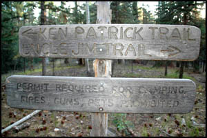
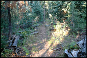
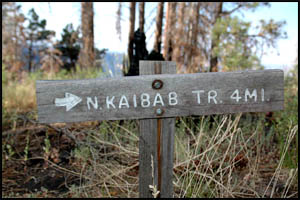
The trail heads to the east
and overlooks Roaring Springs Canyon. It is fairly easy walking and
has a few ups, downs, and turns. I travel the half-mile to the
Uncle Jim Trail junction in just over twenty minutes. At the
junction, the trail turns right for the Uncle Jim Trail and left for the
Ken Patrick Trail. I take the left branch, which immediately gets
easier since the mule rides do not go on this section. There are
numerous fallen trees as you make your way eastward.
 |
 |
 |
Uncle Jim Trail junction
7-17-2006 @ 6:32 |
Fallen trees by trail
7-17-2006 @ 6:43 |
Fallen trees by trail
7-17-2006 @ 6:52 |
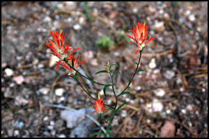
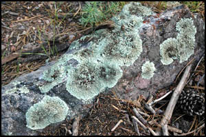
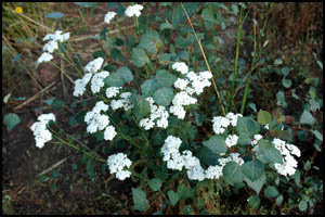
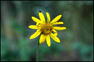
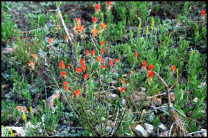
There are plenty of flowers and
lichen as I head down the trail.
 |
 |
Indian Paintbrush
7-17-2006 @ 7:01 |
Lichen
7-17-2006 @ 7:04 |
 |
 |
 |
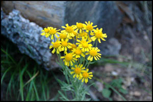
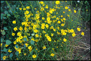
Fetid Marigold
7-17-2006 @ 7:06 |
Gregg Ceanothus
7-17-2006 @ 7:06 |
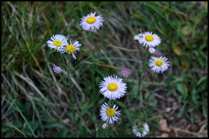
Princely Daisy
7-17-2006 @ 7:06 |
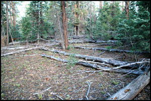
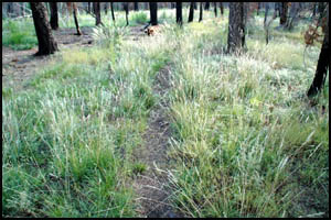
In another twenty minutes, I reach a
section of the trail that is more like a meadow with lots of grass.
 |
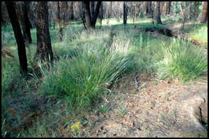 |
Grassy section
7-17-2006 @ 7:25 |
Grassy section
7-17-2006 @ 7:25 |
There are also lots of flowers in this
meadow section.
 |
 |
 |
Hemlock Parsley
7-17-2006 @ 7:36 |
Fetid Marigold & fly
7-17-2006 @ 7:36 |
Fetid Marigold
7-17-2006 @ 7:32 |
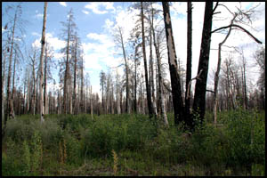
As I approach the
eastern side of this meadow, it is apparent that fire has burned many of the
trees.
 |
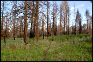 |
Burned tree section
7-17-2006 @ 7:32 |
Burned tree section
7-17-2006 @ 7:37 |
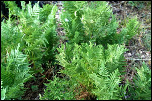
The area east of
the burned tree section is actually quite lush with more flowers and ferns.
 |
 |
Indian Paintbrush
7-17-2006 @ 7:38 |
Ferns
7-17-2006 @ 7:44 |
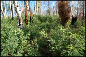
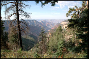
A little bit of
minor bush-whacking is required to get through this area. When I break
out of the bushes, I get my first view of Bright Angel Canyon.
 |
 |
Brushy section of the trail
7-17-2006 @ 7:50 |
Bright Angel Canyon
7-17-2006 @ 7:53 |
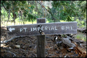
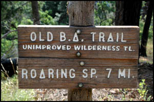
In just under two hours, I reach
the Old Bright Angel Trailhead. The trail branches to the left to
continue on the Ken Patrick Trail and right for
the Old Bright Angel Trail. I
turn left and notice that my GPS no longer displays the Ken Patrick Trail.
It is as if the trail ends here.
 |
 |
 |
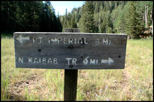
Point Imperial sign
7-17-2006 @ 7:55 |
Old Bright Angel Trailhead
7-17-2006 @ 7:56 |
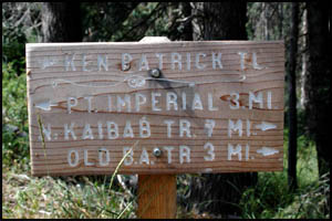
Ken Patrick Trail sign
7-17-2006 @ 7:56 |
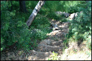
From this point on, the trail is very
indistinct and definitely hard to follow. In just a few minutes, I
loose the trail completely, so I guess it's dead reckoning from here on out.
Fortunately, yesterday I placed a waypoint on my GPS where the trail meets
the Cape Royal Road, so I at least know where I have to end up. I
travel a little ways to the north on a ridge and then decide it's time to
start downhill. It's pretty easy going for a ways, but then things
change abruptly for the worse. The incline is now about 45 degrees,
fallen trees are everywhere, the brush is extremely thick, and all
the bushes have large thorns. This is serious bush-whacking and my
legs and knees are paying the price. I look like I've been in a cat
fight and the cat won. I struggle with this for about an hour until I
finally reach Ice Box Meadow at the bottom. I'm pretty sure I just
earned my Amazon bush-whacking merit badge the last hour. I would rate
that last section as a triple black diamond and the toughest "trail" in the
Canyon I've been on.
 |
 |
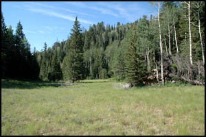
Ice Box Meadow
7-17-2006 @ 9:01 |
Trail sign in Ice Box Meadow
7-17-2006 @ 9:01 |
On the east side
of Ice Box Meadow, I come to some switchbacks. I start up the switchbacks
thinking I've finally gotten the best of this trail. Based on previous
experience in the Canyon, I should know that overconfidence is a mistake.
Sure enough, these are actually very steep, zigzagging switchbacks
that seem to go on forever. Once again I can't recall any Canyon switchbacks
I've done that are tougher than these. I'm glad I am going up these, because they would
not be any fun at all going downhill. I finally break out at the top and
walk the final mile to Cape Royal Road where my wife is waiting for me.
 |
 |
Final section of the trail
7-17-2006 @ 9:41 |
Ken Patrick sign at Cape Royal Road
7-17-2006 @ 9:41 |
What started out
as an easy day hike ended up being a real struggle. I later talked
with a Ranger at the North Rim Backcountry Office about the section of trail
past the Old Bright Angel Trailhead. He confirmed that the NPS has not
cleared out that section like they should have. I have no way of
knowing if the actual trail is any easier than the route I took assuming you
could somehow stay on the actual trail.
MAIN INDEX
|
BACK TO TRIP REPORTS
|
BACK TO NORTH RIM DAY HIKES
|
Copyright © Richard M. Perry, 2004-2023. All rights reserved. This web site, its text, and pictures may
not be copied without the express written consent of Richard M. Perry. |
|