|
ALL HIKERS
DAY 1:
NEW HANCE TRAIL TO LOWER HANCE |
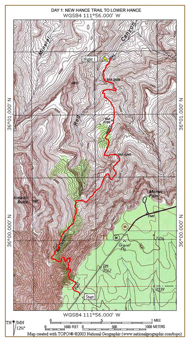
We meet at Moran Point at 6:30. Art and I take
all the packs to the trailhead while Marsha and Shari drive their cars to
Lipan Point. Art and I join them there shortly. This way all our
cars will be at the Tanner trailhead when we finish our hike. Shari
then drives all of us to the New Hance trailhead to begin the hike.
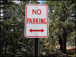
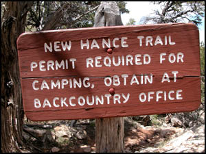
The New Hance trailhead is designated by two "no parking" signs on the
highway. If you are by yourself, it is 1.1 miles from the trailhead to
the nearest paved parking area, the Moran Point parking lot to the east or
the Buggeln Picnic area to the west. There is a forest service road
one-half mile to the west that many people use to park their cars.
|
 |
 |
|
Sign by the highway
trailhead
4-19-2009 @ 7:23 |
Sign by the highway
trailhead
4-19-2009 @ 7:23 |
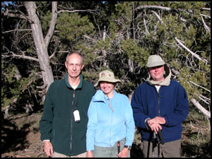
Shari takes our
picture at the trailhead and just after 7:30 we begin the quarter mile walk through a flat
area with numerous juniper trees. The New Hance Trail sign is
the last flat place for some time.
|
 |
 |
|
Richard, Marsha, and Art at the
trailhead
4-19-2005 @ 7:26 |
New Hance Trail sign
4-19-2005 @ 7:38 |
Most of the
websites I visited describe how steep and unrelenting the New Hance Trail
is. They were all accurate. Walking past the trail sign is like
pushing the down button on the express elevator. You better have your
pack straps securely buckled and your boot laces tightened because this baby goes downhill
in a hurry. Marsha explains she is not much of a downhill person and
Art and I quickly outdistance her on the steep trail. The dominant
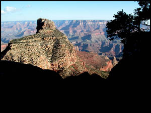
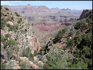
feature on the top half of the New Hance is Coronado Butte on the west side
of the trail. It is reminiscent of O'Neill Butte on the South Kaibab, but larger.
|
|
 |
|
|
|
Coronado Butte
4-19-2005 @ 7:41 |
|
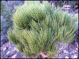
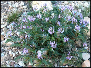
The inner
Canyon is alive with various plant life.
|
 |
 |
|
Mormon Tea
4-19-2005 @ 8:15 |
Purple locoweed
4-19-2005 @ 8:18 |
|
 |
 |
 |
|
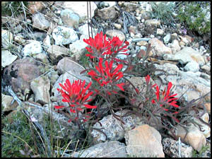
Woolly (Indian) Paintbrush
4-19-2005 @ 8:18 |
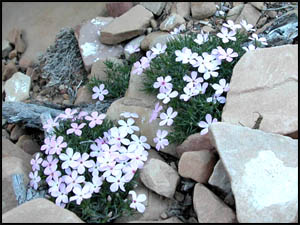
Spreading Phlox
4-19-2005 @ 8:46 |
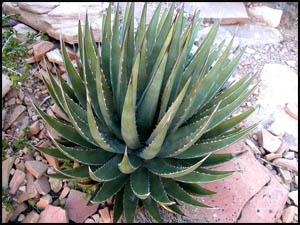
Agave
4-19-2005 @ 8:47 |
After nearly
two hours, we take our first real break in a grassy area near the eastern
base of Coronado Butte. In one more hour, we reach the last green area
in this upper section.
|
 |
 |
|
Eastern base of Coronado
Butte
4-19-2005 @ 9:42 |
Last green area on upper
section
4-19-2005 @ 10:55 |
The trail now turns to the east and then loops around to the north to
what must be the break in the redwall. We continue on that loop
until finally reaching a high promenade with a flat area suitable for
camping. It is about noon so we stop for lunch. Contrary to
what we thought about this being the break in the redwall, the trail
again drops down to the east and loops once again back to the north.
The wind has been blowing about 20 m.p.h. with gusts in the 30-40 m.p.h.
range.
|
 |
 |
 |
|
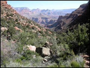
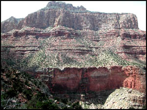
West view of Coronado Butte
4-19-2005 @ 12:53 |
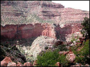
Northwest view
Base of
Coronado Butte
4-19-2005 @ 12:53 |
S.W. view toward
trailhead
4-19-2005 @ 12:53 |
We finally reach the break in the redwall and start down. I have
not been feeling well and am not sure what is causing this. I have
plenty of water and the temperature has been pleasant. The
gusty wind makes traversing this downward stretch exciting (actually a
little dangerous) as it pushes us around from rock to rock. We
reach the base of this section in no time at all in what has to be the
easiest redwall I have ever gone down. For the first time in my
Canyon hiking career, we meet two Park Rangers coming down the redwall
also. They are going west out of Hance Rapids tomorrow. I am
feeling really sick as we reach a flat area at the top of a grassy
meadow. I am so nauseous that I have to lie down. With how I
am feeling right now, I am almost certain that I cannot continue.
Art and Marsha decide to go on to the creek that is about 1.5 miles
farther down. They are going to leave their packs at the creek and
bring back water. I am getting chills, so I get out my sleeping
bag and crawl in. That feels so good that I get out my pads and
pillow for a really comfortable nap. Several groups heading uphill
stop and ask how I am doing. After about two hours of rest, I am
feeling a little better and decide to pack my gear and head downhill
before it gets dark. Hopefully I will meet up with Art and Marsha
before long. In about fifteen minutes, I see Marsha coming up the
trail with Art not too far behind. She carries the fanny-pack
portion of my pack to help reduce my weight. When we meet up with
Art, he carries my pack. That is good because I am now feeling
very sick again and questioning the wisdom of going down farther.
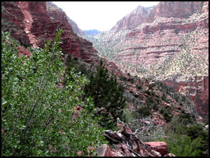
It is easy to see how Red Canyon got its name with its dark red walls.
The trail below the meadow loops back to the east and descends rapidly
along some very fine, red dirt-like soil. This is an area where
one slip would result in a lot of bounces before reaching the bottom.
I found this to be one of the more treacherous areas so far due its
steepness and slick surface. After what seems an eternity, we
reach the place where the trail meets a creek and our campsite. We had originally planned to go
all the way to Hance Rapids, but I am in no condition for any more
travel. We set up camp, I recover just enough to eat, and then all
head to bed.
MAIN INDEX
|
HIKING INDEX
|
BACK TO PREFACE
|
FORWARD TO DAY 2
|
Copyright © Richard M. Perry, 2004-2023. All rights reserved. This web site, its text, and pictures may
not be copied without the express written consent of Richard M. Perry. |
|